

Start here
What's the difference between Malpaís and Santa Teresa?
Think of them as one stretch of coast along one road. Malpaís is the quiet southern end; Santa Teresa is the busier northern end, with most of the hotels and restaurants.
The name goes back to the days when farming, not tourism, paid the bills: the streams ran low every dry season and crops struggled. That same sunny, dry climate is now one of the best reasons to come. Malpaís is still a working fishing village, with rocky coves, tide pools and the Cabo Blanco reserve just down the coast.
Head north and you reach the Playa Carmen crossroads, where the road from Cóbano meets the beach road. This is where you'll find the banks, supermarkets and pharmacy. Santa Teresa runs north from here: a strip of boutique hotels, cafés and yoga studios between the jungle and the sea. Playa Hermosa and Manzanillo carry on north, each a little wilder than the last. The town map shows the whole strip.
Why is the southern tip of the peninsula special?
- Costa Rica's first protected area is next door. The Cabo Blanco Absolute Nature Reserve was created in 1963, thanks to Nils Olof Wessberg and Karen Mogensen, and it inspired the country's national park system. Most of it is still off limits to visitors; the trails start near Cabuya, about an hour away. Parks and reserves.
- Two coasts within 45 minutes. Surf and sunsets on the open Pacific in Santa Teresa, and calm bays on the Gulf of Nicoya on the other side: Montezuma is 35 to 40 minutes away, Tambor about 45, and the Curú refuge about an hour. That's the answer if you're traveling with kids who want to swim.
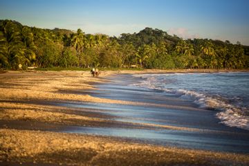
- The peninsula's sunsets. The coast faces west over open ocean, and travel guides single out Santa Teresa for the best sunsets on the peninsula.
- A low-rise village, not a resort town. There's no town center and no high-rise: just one road of small hotels, restaurants and yoga shalas, with the jungle behind. The food and wellness scene is well above its size.
Where to go on the Nicoya Peninsula, south to north
Santa Teresa sits at the end of the peninsula, so the southern tip is easy day-trip country and the north is a second base rather than an outing. Our Nicoya Peninsula guide covers every town, and the Nicoya Peninsula map has the drive times.
Santa Teresa and Malpaís beaches
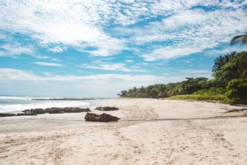
Five beaches on one road: Malpaís, Playa Carmen, Santa Teresa, Playa Hermosa and Manzanillo, all within 20 minutes of each other. Come for long walks, tide pools at low tide and the sunset; swim with care, as the open Pacific has strong currents.

Cabo Blanco and Montezuma
Round the cape, about an hour away, the Cabo Blanco reserve opens Wednesday to Sunday for forest trails down to a wild beach. Nearby Cabuya has an island cemetery you can walk to at low tide. Montezuma, 35 to 40 minutes from Santa Teresa, is a walkable bohemian village with waterfalls in the forest behind it.
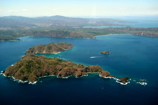
The calm Gulf side
Tambor's wide bay, the Curú Wildlife Refuge and the white sand of Isla Tortuga face the Gulf of Nicoya, where the water is usually calm and clear. They're 45 minutes to an hour from Santa Teresa, and the Tortuga boats pick up in town: the easy family day out.
Coyote to Punta Islita
North of Manzanillo the coast gets remote. Playa Coyote, San Miguel and the bay at Punta Islita are about 1½ to 2 hours away on a coastal track with river crossings, passable by 4x4 in the dry season only.
Sámara and Carrillo
The peninsula's family beaches: a walkable Tico town on a reef-protected bay, and a palm-lined crescent next door. About 4 to 4½ hours from Santa Teresa by paved road, or around 2 hours from Liberia airport.
Nosara and Ostional
Surf, yoga and quiet, with no building on the beach at Playa Guiones. The Ostional refuge next door is one of the world's two main nesting beaches for olive ridley turtle arribadas. About 4½ to 5 hours from Santa Teresa; compare the two in Santa Teresa vs Nosara.
Nicoya town and the Blue Zone
Inland, the colonial town of Nicoya, the Blue Zone villages, the pottery village of Guaitil and the caves of Barra Honda make a rewarding stop on the way north, 3 to 3½ hours from Santa Teresa.
How do you get to Santa Teresa?

From San José airport (SJO) it's 5½ to 6 hours by road and the Puntarenas–Paquera ferry, or 6 to 6½ hours all the way by road. From Liberia airport (LIR) it's 4½ to 5½ hours. The quickest way is a 30- to 35-minute flight from San José to Cóbano airport (ACO), then 25 to 30 minutes by road. Coming from Jacó or Manuel Antonio? The water taxi crosses the gulf in about an hour.
Where should you stay?

Couples usually pick a boutique hotel near the sand in Santa Teresa or Playa Carmen, or somewhere quieter in Malpaís. Families often take a villa or a family suite; Playa Hermosa, wide and quiet, is a favorite. Our where to stay guide compares the areas and lists every hotel we cover.
Can you learn to surf here?

Yes. A first lesson is a fun morning for couples, kids and teens, and Playa Hermosa's gentle beach break is the usual place to learn. More about surf lessons.
Frequently asked questions
What's the difference between Malpaís and Santa Teresa?
They're one stretch of coast along one road, about 11 km long. Malpaís is the quiet southern end: a fishing port, rocky coves and tide pools. Santa Teresa, north of the Playa Carmen crossroads, is busier and has most of the hotels, restaurants and shops. Playa Hermosa and Manzanillo carry on north, each quieter than the last. See the town map.
Where is Santa Teresa, Costa Rica?
At the southern tip of the Nicoya Peninsula, on the Pacific coast. It's in the province of Puntarenas, not Guanacaste, and it isn't in the Nicoya Blue Zone, which lies further north. By road it's about 5½ to 6 hours from San José airport (SJO) and 4½ to 5½ hours from Liberia airport (LIR). See the Nicoya Peninsula map.
How do I get to Santa Teresa from San José?
Three ways. Drive to Puntarenas and take the car ferry to Paquera (about 70 minutes on the water), then drive about 1¼ hours more: 5½ to 6 hours door to door. Or drive all the way around by road via the La Amistad bridge, 6 to 6½ hours with no ferry. Or fly from San José airport to Cóbano airport (ACO) in 30 to 35 minutes and ride 25 to 30 minutes to your hotel. Compare the routes.
Should I fly into Liberia or San José for Santa Teresa?
Either works. From Liberia airport (LIR) it's 4½ to 5½ hours by paved road with no ferry, which suits you if you're coming from the Guanacaste beaches. San José airport (SJO) is better if you're coming from Arenal, Monteverde or Manuel Antonio, or if you want the 30-minute connecting flight to Cóbano. See the driving map.
Do I need a 4x4 in Santa Teresa?
Not to get there. The road in from Cóbano is paved to within a few kilometers of the coast; the last stretch and the town road are dirt and gravel, rutted in the rainy season, so a car with good clearance helps. You only need a real 4x4 for the coastal track north to Coyote and Sámara, with river crossings, and only in the dry season.
Can you swim at Santa Teresa?
Carefully. The open Pacific beaches have strong currents, and swimming there is best left to confident swimmers in small surf. The calm options are the tide pools at Malpaís and El Peñón at low tide and the south end of Playa Hermosa. For truly calm water, the Gulf beaches at Tambor and Curú are 45 minutes to an hour away. See the beaches.
Is Santa Teresa good for families?
Yes, especially with older kids and teens, who'll love the surf lessons, tide pools and Cabo Blanco hikes. With young children, plan days on the calm Gulf side (Tambor, Curú, Isla Tortuga), or consider a base in Sámara, where the bay is reef-protected. Read Santa Teresa with kids.
How many nights should I spend in Santa Teresa?
At least four. The journey takes most of a day each way unless you fly, so three full days on the coast is the minimum to make it worthwhile. Many travelers end a Costa Rica trip here after Arenal and Monteverde; see our itineraries.